Variability and extremes in weather, hydrology and other forces is characteristic for the Sacramento-San Joaquin Delta. Detecting the effects of management actions within these larger external changes can be difficult if you are not routinely looking for it. This web page summarizes the significant changes observed by the scientists who measured the effectiveness of management actions in the Delta throughout 2025.
Introduction
Using data to track the health of California’s Delta is critical to achieving a reliable statewide water supply and a resilient ecosystem that protects and enhances the Delta as a place where people live, work, and recreate. Environmental managers and scientists who work in the Delta must be informed about the Delta Plan’s performance measure changes annually to:
- Ensure that environmental decision-making is based on the best available science and
- Evaluate the overall effectiveness of Delta Plan implementation.
Changes over multiple years that indicate significant trends could lead to potential amendments to state policy, the Delta Plan, and on-the-ground management approaches. This web page aims to communicate the yearly progress of performance measures.
The performance measures featured in the collapsible accordion bars below reflect the changing conditions that scientists observed throughout the 2025 water year. More information about each can be found on their respective web pages.
2025 CONDITIONS
In 2025, California experienced average statewide precipitation for a third consecutive water year, with rainfall 96 percent of normal. Northern California had above-average precipitation, while Central and Southern California had below-average precipitation. In addition, much of the state experienced warmer than average temperatures throughout the year. In Southern California, dry and warm conditions during fall and winter fueled large wildfires. Key water reservoirs were maintained at or above 100 percent capacity for most of the year.
Performance Measure Spotlights
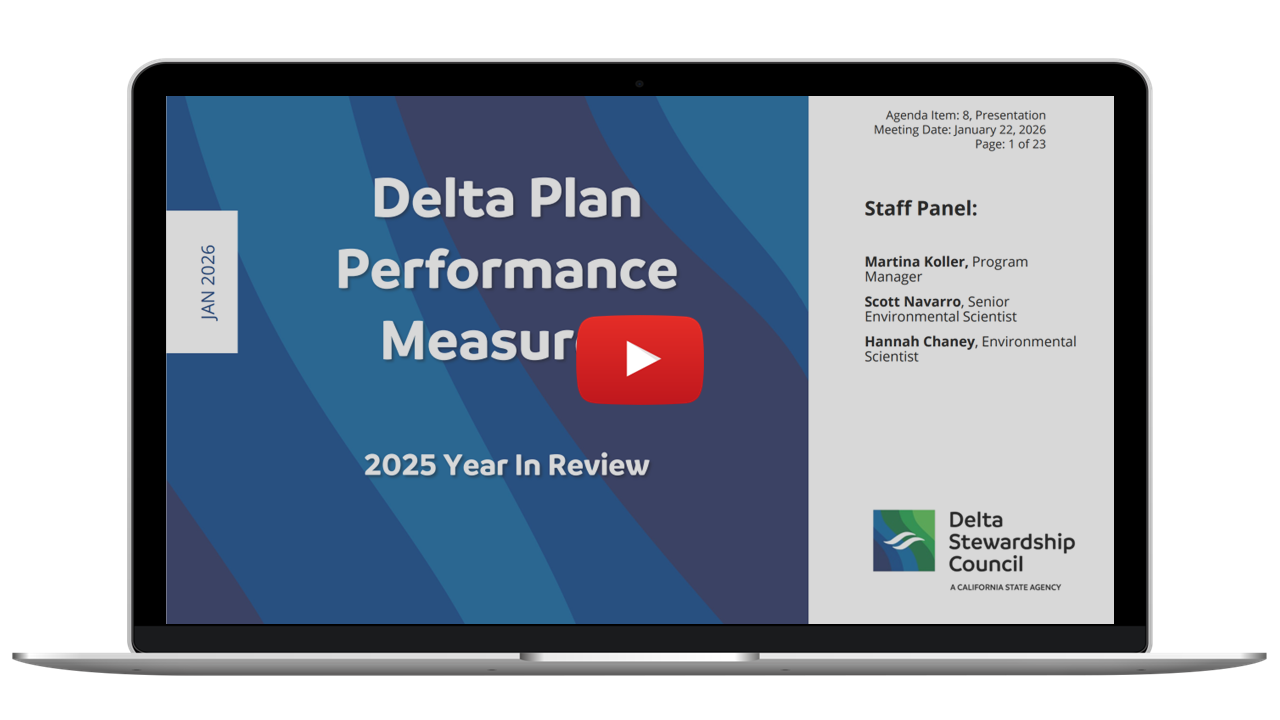
In addition to the spotlighted performance measures below, Council staff presented the 2025 Year in Review at its January 2026 meeting. The presentation slide deck is available on our Council meetings web page, and a recording of the presentation is available on YouTube.
Why measure Urban Water Use?
Monitoring improvements in urban water conservation and water use efficiency is critical to understanding local self-reliance and reduced use of Delta water. The Council’s urban water use performance measure tracks gallons of water per capita per day used and the water conservation targets set by individual water suppliers.
What happened in 2025?
The 2025 Urban Water Management Plans (UWMPs) are to be submitted to the Department of Water Resources (DWR) by July 2026. DWR published a draft guidebook for 2025 UWMPs in November 2025 and finalized in January 2026 with additional guidance regarding the length of water storage, direct potable reuse, and ocean desalination permitting. The 2025 UWMPs will again include a voluntary option to conduct “Reduced Reliance on Delta Analysis.” Additionally, new State Water Resources Control Board water conservation regulations took effect on January 1, 2025, requiring urban water suppliers to set and meet new annual urban water use objectives for indoor and outdoor water use. These regulations include an annual reporting requirement.
Why is this important?
More efficient urban water use supports a reliable water supply for Californians. Efficient use of urban water supply supports the Delta Reform Act by reducing reliance on Delta water by lowering individual demand and improving regional self-reliance.
What are some next steps?
Water suppliers will be submitting their 2025 Urban and Agricultural Water Management Plans to the Department of Water Resources by July 2026. Subsequently, DWR submits a report to the California legislature regarding continued progress toward meeting the statewide target of 20% reduction in water use. Additionally, urban water suppliers will be submitting annual urban water use report to the State Water Resources Control Board by December 2026.
Why track Restoring Ecosystem Function?
Achieving a healthy Delta ecosystem requires protecting, restoring, and enhancing tens of thousands of acres of functional, diverse, and interconnected habitat that maintains resilience under changing climate conditions. Restoration projects need specific attributes to ensure that restored areas contribute to the overall Delta ecosystem and to maximize the effectiveness of individual actions. These preferred project attributes include restoring ecosystem processes - such as hydrologic, geomorphic, and biological functions - being large scale, improving connectivity, supporting native vegetation, and contributing to special status species recovery. Under the Delta Plan Policy (ER PA), restoration projects must have at least four of these five attributes to be counted as Tier 1 or Tier 2 projects.
What happened in 2025?
Since 2013, 29 ecosystem restoration projects have filed for consistency certification under the Delta Plan and are now in various stages of implementation (see also Restoring Land-Water Connections for the year of completion). In 2025, when the Delta Plan Policy ER PA became effective, three restoration projects disclosed specific ecosystem attributes using the ER PA Checklist:
- Webb Tract Wetland Restoration Project (Tier 1)
- Cache Slough Mitigation Bank (Tier 2)
- Georgiana Slough Erosion Control and Habitat Enhancement Project (Tier 2)
Why is this important?
Restoring ecosystem functions is a slow, gradual process. Recent restoration projects in the Delta have been designed and built to better promote ecosystem functions and acknowledge social benefits. Funding is needed to implement and support projects with desired attributes that contribute to the overall effectiveness of restoration actions.
What are some next steps?
The Delta Plan calls for restoring 60,000 to 80,000 acres of habitat by 2050, emphasizing social benefits, tribal engagement, and compatibility with existing land uses. Delta Plan policy ER PA requires projects to disclose specific attributes to ensure that restored areas contribute to the overall Delta ecosystem. Restoration investments in the Delta are increasingly focused on projects that restore natural processes and reconnect water and land. Additionally, an alternative permitting pathway to fast-track ecosystem projects meeting specific requirements are available through Statutory Exemption for Restoration Projects program (SERP) offered by the Department of Fish and Wildlife.
Why measure Yolo Bypass Inundation?
Yolo Bypass is a large floodplain habitat covering nearly 60,000 acres and located adjacent to the lower section of the Sacramento River. The Bypass can convey up to 80% of the flow of the Sacramento River basin during high-water events, providing important flood control for nearby urban areas and also supporting native fish spawning and rearing when flooded.
What happened in 2025?
In 2025, the Yolo Bypass flooded in the spring for a third year in a row for at least 14 consecutive days, meeting the desired duration, frequency, and extent targets for floodplain inundation. Additionally, the Yolo Bypass Salmonid Habitat Restoration and Fish Passage Project, or the Big Notch Project, came online in November 2025. The Big Notch Project gates will allow Sacramento River flows to enter the Yolo Bypass at times when the river elevation reaches 15 feet through March 15 of each year, allowing for longer, larger, and more frequent floodplain habitat inundation.
Why is this important?
The frequently flooded Yolo Bypass has the potential to contribute to the growth of native migratory fish species, and the Delta food webs by restoring floodplain and wetland ecological functions. Native fish species such as Chinook salmon, steelhead, and Sacramento Splittail exhibit higher growth rates and, consequently, higher survival rates after migrating through the Yolo Bypass.
What are some next steps?
Monitoring environmental ecosystem outcomes will continue through the Yolo Bypass Fish Monitoring Program run through the Department of Water Resources with support from the Interagency Ecological Program (IEP). The Yolo Bypass Fish Monitoring Program has collected long-term data on fish invertebrates, chlorophyll, and water quality in the Yolo Bypass since 1998. It is expected that Big Notch will make measurable contributions to food web health and fish growth.
Why measure Salmon Doubling?
Salmon are native anadromous fish and a strong indicator of ecosystem health. The Delta Plan aligns with the state and federal goal of doubling the natural production of Central Valley salmon long-term. The performance measure tracks the annual average natural production of Chinook salmon in the Central Valley for select rivers of the Sacramento-San Joaquin Delta watershed. Salmon abundance is used as a proxy for natural production because abundance data are more readily available than natural production data.
What happened in 2025?
Central Valley chinook salmon born and raised without human help, or natural production, increased from 44,380 in 2022 to 131,741 in 2023 and 115,125 in 2024. The Feather and American Rivers in the Sacramento River watershed and the Mokelumne, Stanislaus, and Tuolumne Rivers in the San Joaquin River watershed nearly doubled their salmon counts. Salmon continues to decline in other Delta watershed tributaries, and the Sacramento River winter-run and spring-run salmon are approaching extremely low numbers. In 2024, the total natural production estimate for the Sacramento River watershed was 85,653, or about 11 percent of the target. The total natural production estimate for the San Joaquin River watershed was 29,472 fish, or about 34 percent of the target. Overall, population numbers remain below the 1967-1991 baseline levels of 497,054.
Why is this important?
The Delta is an important habitat for Central Valley salmon populations as they migrate between upstream tributaries and the Pacific Ocean. Salmon plays an important role in ecosystems. In addition to ecological importance, salmon have sociocultural significance to many Native American communities and are an integral part of California’s fishing industry.
What are some next steps?
The California Salmon Strategy 2025 Report summarizes annual progress and updated actions to stabilize and recover California salmon populations and restore entire aquatic ecosystems in the face of climate change. Some of these actions include removing fish passage barriers, restoring habitat, protecting water flows, modernizing hatcheries, and strengthening agency coordination to rebuild California’s salmon populations.
Why measure Invasive Species?
Nonnative invasive species are both a symptom of a highly degraded ecosystem and a major obstacle to the successful restoration of the Delta ecosystem, as they can affect the survival, health, and distribution of native Delta plants and wildlife. Native species are impacted by nonnative invasive species through competition, predation, disease, and other interactions. The Delta Plan includes both a regulatory policy (Cal. Code Regs., tit. 23, § 5009.) and a recommendation to prevent introductions of new nonnative invasive species and to manage nonnative species impacts. (Delta Plan Policy ER P5 and Recommendation ER R7)
What happened in 2025?
Golden Mussel
In 2025, Golden Mussels spread throughout the central and southern Delta and to areas farther south via the California Aqueduct. They are now found as far south as Pyramid Lake in the Grapevine and Riverside in Southern California. The Golden Mussel Response Framework was published in April 2025, a multi-agency effort led by California Department of Fish and Wildlife (CDFW) to prevent further introductions and limit spread, and to contain and suppress the species. In June 2025, the State Lands Commission enacted an emergency regulation requiring offshore treatment of ballast water before discharging into inland ports. (Cal. Code Regs., tit. 2, §§ 2292, 2293.) This emergency regulation was readopted in December 2025. Ballast water discharges by ocean cargo ships at the inland ports of Stockton are the likely entry points of Golden Mussels into the Delta. Also, effective on December 30, 2025, the Fish and Game Commission approved a permanent regulatory addition of zebra, quagga, and Golden mussels to the restricted species list. (Cal. Code Regs., tit. 14, § 671.) In September 2025, in Assembly Bill 149, the Legislature appropriated an additional $20 million of Proposition 4 bond funds to CDFW to address invasive mussels and added a definition of “invasive mussels” in Fish and Game Code section 2301.
Nutria
Nutria is one of the recently introduced invasive species and is being managed to prevent establishment. In 2025, Nutria continues to proliferate, as evidenced by the highest take since the program began in 2017. During the year 2025, 2,076 nutrias were taken (560 in the legal Delta and 532 in the Suisun Marsh). The total take of nutria between 2017 and 2025 was 7,503 individuals (1,253 in the legal Delta and 1,053 in the Suisun Marsh.
Mute Swans
Mute Swans are large, nonnative birds weighing around 30 pounds and measuring about 5 feet in length, with a wingspan of 8 feet, and have proliferated in the Delta, particularly within Suisun Marsh. Mute Swans are very territorial and aggressive, outcompeting native species for limited wetland habitats. They have been reported to attack people and critically injure pets and other waterfowl. Mute Swans were first detected in the Suisun Marsh in 2007 and now have an estimated population of 6,900 birds. Effective January 1, 2026, Fish and Game Code section 3801 allows for the take and possession of the bird by those with a valid California hunting license. The law currently has a repeal date of January 1, 2031
Why is this important?
Golden Mussel
The rapid response to the golden mussel introduction is key to preventing further introductions and spread within the state, thereby minimizing and mitigating impacts on the economy, infrastructure, and the environment. Updated regulations and new funding mechanisms will help support the management and response to the golden mussel threat.
Nutria
The number of nutrias found within the legal Delta and Suisun Marsh has significantly increased, accounting for more than half of the total nutrias taken in 2025. Nutria are large semi-aquatic rodents that breed prolifically and can damage water conveyance systems and flood infrastructure, as well as vulnerable wetland habitats and agriculture.
Mute Swans
Allowing for the take and possession of Mute Swans may reduce and control the invasive species' population. A reduction in Mute Swans may benefit native species by reducing competition for the limited wetland habitat.
What steps are being taken in 2026?
Golden Mussel
CDFW and other state, local, and federal agencies continue to respond to the golden mussel threat. Several prevention and mitigation strategies are being implemented, along with ongoing research on treating water infested with mussels.
Regular updates on the invasive golden mussel in California are provided on CDFW’s website.
Nutria
CDFW, in collaboration with other agencies, continues the nutria eradication program to eliminate the population in California.
Regular updates on invasive nutria control in California are provided on CDFW’s website.
Mute Swans
Effective January 1, 2026, Fish and Game Code section 3801 allows for the take and possession of the bird by those with a valid California hunting license. The law currently has a repeal date of January 1, 2031.
For more details, view invasive species performance measure.
Why measure Farmland Mapping
Agriculture remains the Delta’s predominant land use and economic foundation. Preserving farmland supports local communities and sustains the region’s rural character. The Delta Plan prohibits new unplanned residential, commercial, and industrial development outside designated urban areas, thereby reinforcing the Delta’s agricultural heritage. (Cal. Code Regs., tit. 23, § 5010; Delta Plan Policy DP P1) The Sacramento-San Joaquin Delta National Heritage Area Management Plan, adopted in 2025, promotes the unique agricultural character of the Delta and further advances historic preservation, farming legacy, cultural interpretation, and natural resource stewardship.
What happened in 2025?
Between 2018 and 2020, a total of 667 acres of Delta farmland were converted to urban uses. This adds to the 2,150 acres that had already been converted since 2012. Importantly, all of these conversions occurred within areas previously designated for development in the city and county general plans when the Delta Plan was adopted in 2013. Delta farmland, as defined by the Delta Plan, is the summed area of several agricultural categories, including prime farmland, grazing land, and farmland of local and statewide importance. For more details, view the farmland loss performance measure on our dashboard.
Why is this important?
It is important to track and anticipate future impacts of farmland conversion, as defined by Delta Plan Policy DP P1. Monitoring for conversions from farmland to urban development shows if targets that support the Delta Plan’s goals are being met. Knowing how much farmland is planned for conversion also helps communities prepare for impacts on water needs and infrastructure, while ensuring balanced growth without reducing vital agricultural land.
What are some next steps?
The Department of Conservation is processing remotely sensed data to update the 2022 Farmland Mapping and Monitoring Program. The release of the 2022 data for the Delta counties is expected between mid to late 2026.
Why measure the National Flood Insurance Program (NFIP) Community Rating Score?
Flood insurance is crucial to the Delta, where approximately 77 percent of the land is designated as Special Flood Hazard Zone (SFHA) by the Federal Emergency Management Agency (FEMA). Property transactions in an SFHA require a purchase of flood insurance if the buyer is using a government-backed mortgage. The NFIP offers a community rating system as a voluntary incentive program to encourage activities that promote flood safety beyond minimum NFIP requirements. Flood insurance policyholders in communities achieving high rating scores receive discounts on their insurance premiums. The Delta Plan recommends increasing Delta community participation in the NFIP’s Community Rating System discount program to promote flood insurance availability and limit state liability in the event of a flood.
What happened in 2025?
Following a modest increase in Community Rating System scores in Delta communities between 2013 and 2023, 2025 rating scores have decreased by 5 percent since 2023 and by 15 percent since 2013. Additionally, Lathrop and Manteca, both partially located within the Delta, participated in the program in 2013, but no longer meet the minimum requirements to receive NFIP discounts for their residents in 2025.
Why is this important?
This data highlights a decrease in Delta community flood management investments. In 2025, FEMA faced funding constraints, and the federal government shutdown stalled the purchase of NFIP insurance plans. The instability in NFIP’s funding and future may impact the rate of flood insurance utilization by Delta residents. Fewer residents in the Delta without flood insurance means less resilience in the face of future floods.
What are some next steps?
Data that tracks participation in the Community Rating System program by Delta communities is updated every 2 years. It is also important to acknowledge alternatives to NFIP. For example, the City of Isleton, a Delta town, has formed a Geologic Hazard Abatement District (GHAD) and received a grant from the Department of Water Resources in 2022 to purchase a community-based insurance policy. Tracking the success of programs like the Isleton GHAD provides more insight into the viability of flood insurance alternatives to NFIP in the Delta.